
Projects
Rattler Gulch - Booth Ranch - Retracement Survey
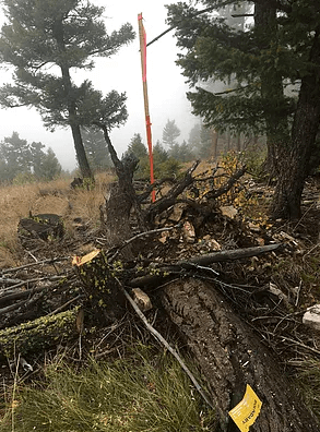
This was a Retracement/Dependent Resurvey of the rectangular PLSS on a private ranch located up Rattler Gulch near Drummond Montana. Old Stimpson Lumber Company land. Our job was to find or establish all property corners and mark all boundary lines for future fencing and gating purposes. We conducted a GPS Control Survey and Traversed section lines between control. We found and/or perpetuated 35 property and/or section corners. We marked 11 miles of exterior boundary lines placing galvanized steel post at inter-visible intervals being approx. 200-250 ft. The property encompassed 3.5 sections of land and contained 2,250 acres of steep terrain. We prepared a Certificate of Survey depicting all work accomplished. We also prepared Certified Corner Recordation Forms as they pertain to found section corners and Montana State Law. All documents were filed it with the Granite County Clerk and Recorder.
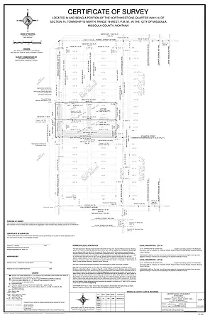
Lot Survey
This was a Lot / Boundary Survey conducted in the Rattlesnake neighborhood within the City of Missoula Montana. Our clients were planning on renovations to their existing house and possibly building a Car-port. In Missoula, building permits are required and part of a building permit is knowing if you meet current city and county Zoning Regulations. This project was conducted for two separate clients (Neighbors) and they were able to save $$ by hiring GLS simultaneously. They needed to know how the existing structures on their property related to the real location of their property boundaries and if thier proposed design for new structures could be built while maintaining Zoning Compliance. GLS conducted a boundary survey and found or set all exterior property corners. We then mapped the existing structures and put together a sitemap for submittle to the City and County for a building permit. We continued our office work and submitted a Retracement COS for recording in Missoula County.
Mineral Survey - Wickiup Cr Ranch - Retracement
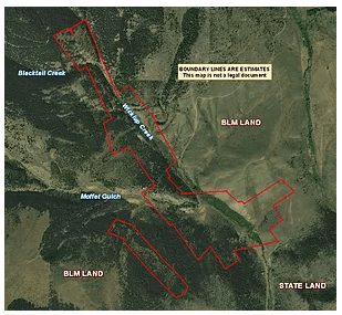
This project took place in the Wickiup drainage in Silverbow County Montana. Our job was to find or establish all property corners and mark all boundary lines for future fencing and gating purposes. We conducted a GPS Control Survey and Traversed boundary lines between control. We found and/or perpetuated 76 Mineral Survey / property corners. We marked 6 miles of exterior boundary lines placing galvanized steel post at inter-visible intervals being approx. 200-250 ft. The property encompassed 16 Mineral Claims and contained 330 acres of steep terrain. We prepared a Certificate of Survey depicting all work accomplished. We also prepared Certified Corner Recordation Forms as they pertain to found section corners and Montana State Law. All documents were filed it with the Silverbow County Clerk and Recorder.
Elevation Certificate - Kings Christian Church
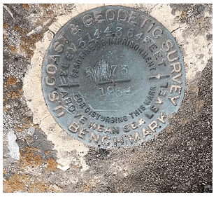
This project pertained to an Elevation Certificate done for the Kings Christian Church located in beautiful Lolo Montana. The church was trying to sell their property and were told by the local mortgage and insurance agencies that the property was located within the 100 year flood zone per the Federal Emergency Management Agency (FEMA) and that they would need a elevation Certificate to do so, provided that the existing structures were in reality out of the 100 year flood zone. Survey work included surveying three local USGS published benchmarks. We carried the elevation of these benchmarks to the church property utilizing Trimble R8 GPS system. We collected all necessary field measurements as they pertained to the FEMA regulations. We created the approriate Elevation Certificate documentation for submission to the local mortgage and insurance companies.
GLS go this project completely do to a quick response time. We found out about this project on a Friday afternoon and the project was finished and in our clients hands by the following Tuesday. (2 days)


